
Analysis of the historical system
In 1837, apart from the village Zackenzin there was also a farm. This is confirmed by the map from the first half of the nineteenth century, where within a short distance to the southeast of the village Zackenzin (Ciekocino) was the Lonisenhof farm.
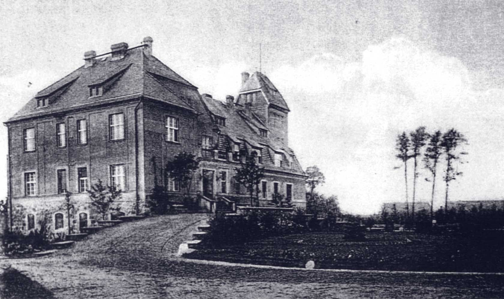
In the second half of the nineteenth century the Lonisenhof farm already bears the name Zackenzin, just like the village located a short distance to the northwest. Based on a map from 1894, we know that in the second half of the nineteenth century the northern part of the pasture (Die Koppel) was developed and the farm complex – the farm courtyard with outbuildings – was probably built. The road limiting the pasture from the west, already existing in the first half of the nineteenth century, was used as a driveway to the building, it could have been the manor house. At that time, the small-leaved limes and thuja trees were probably planted. In the eastern part, there may have been a park, maybe a forest park, which included trees constituting elements of naturalistic composition.
The composition of the establishment was based on two intersecting axes. One of them, the east – west axis lead through the farm courtyard surrounded with outbuildings, the driveway to the farm courtyard, the manor courtyard with the driveway to the manor house, the manor house, the garden with the pedunculate oak on the axis, surrounded with a forest buffer zone.
The second, north-south axis, which is also the viewing axis, lead through the manor house, the viewing area in the meadow, the pedunculate oak, part of the forest park which played a significant role in the landscape formation of the park. The viewing area in the meadow was surrounded with the forest park, and the more interesting examples of trees in the western part included: the Jack Pine, the red oak and the spruce. In the south-west corner: a group of European larch trees, in the southern part of the axis: the pedunculate oak of the fastigiata type, in the south-east corner: an avenue of European larch trees, in the east: common red-leaved beech trees, and in the northern part in front of the southern elevation of the manor house: thuja trees, small-leaved lime trees. Two plane trees accentuated the entrance in the eastern elevation. The axis with the entrance in the eastern-western axis led through the middle of the flower bed situated in the courtyard with the pedunculate oak on the axis. The flower bed also includes junipers and thuja trees, symmetrically planted on both sides, and two midland hawthorns.
In the northern part of the driveway there were: common pines, the Black Locust, silver firs, common beech trees, an avenue of conifers, which probably surrounded the driveway and the viewing area in the meadow in the north. It included: silver firs, common pines, European larches, yews. The lawns around the driveway were planted with: snowberry, lilac, mock orange shrubs. In the northern part, behind the farm complex, there was a vegetable garden, and in the southern part, between the pasture and the meadow surrounded with the park forest, there was an orchard. The road leading through the village in its eastern part was surrounded with a cherry plum hedgerow and an avenue of ash trees, and the eastern boundary of the pasture with ash trees. On the northern boundary of the establishment, on the southern part of the road from Kurowo to Ciekocino, residential buildings were built and, probably in the years 1935-1940, a group of boundary trees was planted: red oaks, small-leaved limes, pedunculate oaks, common maples. The northern boundary of the establishment was moved to the main rural road, where cherry plum hedgerow was planted. Avenues were created: mixed (spruces, maples, lime trees) limiting the grounds of the former orchard from the east, next to the road leading to the fields and an avenue of ash trees and a plum cherry hedgerow next to the exit road to the field, limiting the pasture from the east.